Search Results
Showing results 1 to 2 of 2
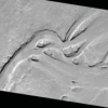
Mars from Above: Carving Channels
Source Institutions
In this activity, learners create channel features with flowing water, comparing their observations to real images of Mars and Earth taken by satellites/orbiters.
Exploring Earth: Temperature Mapping
Source Institutions
This activity models the way Landsat satellites use a thermal infrared sensor to measure land surface temperatures.