Source Institutions
Source Institutions
Add to list Go to activity
Activity link broken? See if it's at the internet archive
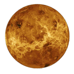
In this activity, learners mimic remote sensing. Learners use a stick to measure the distance to a "planet surface" they cannot see, and create their own map of the landscape. Use this activity to discuss how scientists use remote sensing to explore the surface of Venus.
- 10 to 30 minutes
- 10 to 30 minutes
- $5 - $10 per student
- Ages 6 - 11
- Activity, Simulation
- English
Quick Guide
Materials List (per student)
- Several opaque boxes with a landscaped interior and holes in the top
- Solid items to serve as landscapes, like Styrofoam blocks or cones, Tupperware containers, plastic bottles, etc.
- Glue to secure the landscape if needed
- A wooden dowel for each box that is 6” longer than the box is tall
- A sheet to “Take Your Data”
- A sheet to “Make Your Map”
- Permanent markers in several different colors
- Crayons
Subjects
-
Earth and Space Science
-
Astronomy
- Probes, Satellites and Spacecraft
-
Solar System
- The Planets
-
Astronomy
-
Engineering and Technology
-
Engineering
- Aerospace Engineering
-
Engineering
-
Mathematics
- Measurement
-
Physical Sciences
-
Vibration and Waves
- Wave Properties
- Wave Motion
-
Light and Optics
- Electromagnetic Spectrum
- Reflection and Refraction
-
Vibration and Waves
-
The Nature of Science
-
The Scientific Process
- Conducting Investigations
- Gathering Data
- Formulating Explanations
- Communicating Results
- Science as a Career
-
The Scientific Process
Audience
To use this activity, learners need to:
- see
- read
- touch
Learning styles supported:
- Involves hands-on or lab activities
Other
This resource is part of:
Access Rights:
- Free access
By:
Rights:
- All rights reserved, Lunar and Planetary Institute, 2009