Source Institutions
Source Institutions
Add to list Go to activity
Activity link broken? See if it's at the internet archive

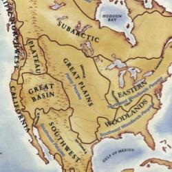
This is a culminating activity which allows learners to summarize what they know about Woodlands Native Americans by creating illustrations and map symbols for a large outline map (see related Activity 2: If You Lived in a Forest). Learners can add illustrations to the map as they study other cultural regions in subsequent lessons. This activity is featured on p.19 of the "One With the Earth: Native Americans and the Natural World" multidisciplinary unit of study for kindergarten through third grade.
- 10 to 30 minutes
- 45 to 60 minutes
- $1 - $5 per group of students
- Ages 4 - 11
- Activity, Lesson/Lesson Plan
- English
Quick Guide
Materials List (per group of students)
- map of North America
- masking tape or painter's tape
- poster paper and markers or chalk board and chalk
- assortment of maps
- construction paper
- crayons
- resource books
Subjects
-
Earth and Space Science
-
Earth Processes
- Weather and Climate
-
Earth Structure
- Rocks and Minerals
- Oceans and Water
- Earth's History
-
Earth Processes
-
Life Sciences
-
Diversity of Life
- Plants
- Animals
-
Ecology
- Ecosystems
- Evolution
-
Diversity of Life
-
Mathematics
- Representation
Informal Categories
- Animals
- Nature and Environment
Audience
To use this activity, learners need to:
- see
- read
- touch
Learning styles supported:
- Involves teamwork and communication skills
- Links STEM to other topics of interest such as arts and humanities
- Involves hands-on or lab activities
Culture, ethnicity, and gender
-
Native American
- Acknowledges this group's contributions to STEM
- Uses inclusive images of people from this group
Other
Components that are part of this resource:
Includes alignment to state and/or national standards:
This resource is part of:
Access Rights:
- Free access
By:
Rights:
- All rights reserved, The Children's Museum of Indianapolis,
