 On November 5, 2008, a few days after Barack Obama was elected president, Daniel Edelson wrote an open letter to the man who would soon occupy the White House.
Edelson, National Geographic’s Vice President of Education, delivered an eloquent plea, asking that the new administration “take up the cause of geographic education.”
“Many of the challenges we face in today’s world,” Edelson wrote, “are the result of our failure to recognize [that interconnectedness is the essence of modern geography]….The growth of Anti-American sentiment abroad in recent decades, this year’s global food shortages, human-induced global warming, and the international credit crunch of the last quarter are all examples of how our interconnectedness magnifies the impact of decisions that individuals, businesses, and governments make.”
“The U.S. has done a dismal job of educating our young people about the world and the complex interdependencies that link us to each other and to the natural resources and ecosystems that sustain us,” Edelson continued, and then asked the president-elect to “make sure that learning about this interconnectedness and how to account for it in decision-making will be part of the education that every student in America receives.”
Two years later
Howtosmile.org recently asked Dr. Edelson what has happened since he sent that letter in 2008. Does Edelson still "see the possibility that the administration will take up the cause of geographic education?"
Edelson replied, “Since 2008, we have seen a lot of important progress at the federal level, but there is still a long way to go. We have had some very positive conversations with the policy office at the Department of Education. They clearly recognize the value of geographic literacy, and they have been very receptive to our suggestions about how to move geography education reform forward.
"The Administration has two strategies for reversing the narrowing of the curriculum that has resulted from No Child Left Behind. They are looking to increase resources for STEM [Science, Techonology, Engineering and Math] education and for what they are calling a 'well-rounded curriculum' which includes social studies, foreign languages, arts, and other subjects.
"Recognizing that geographic content and skills are taught in both science and social studies, they have encouraged us to think of both of these as sources of potential funding for geography education programs. We've gotten similar encouragement from leaders in both parties in the House and Senate. However, our biggest challenge is that all education reform at the federal level is held up by political gridlock."
 Mapping the President
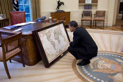
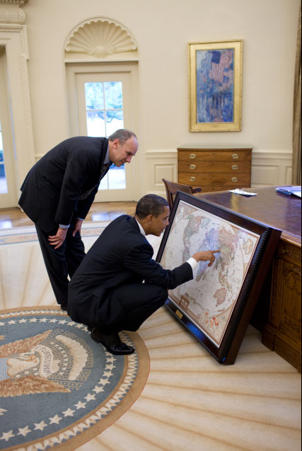
"With respect to President Obama himself," says Edelson, "he, like his predecessors in the Oval Office, received a custom-made map case from the National Geographic Society shortly after his inauguration. I have been told by someone who was told by someone else who works in the White House, that the President makes good use of the maps and likes to show them to visitors.”
National Geographic’s tradition of giving U.S. Presidents world maps began when Gilbert H. Grosvenor, then President and Editor of the National Geographic Society, presented the first map cabinet to President Franklin D. Roosevelt (in office from 1933 through 1945) a few weeks after the start of the Second World War.
Roosevelt liked the map cabinet so much that he asked National Geographic to give a second map cabinet to Winston Churchill, Prime Minister of Great Britain. Roosevelt and Churchill used National Geographic maps to plan Allied war strategy. On one map of Germany, Roosevelt sketched proposed zone boundaries for the supervision of Germany after the war.
More about National Geographic’s gift of maps to President Obama.
Photos courtesy of the White House. "This is one gift I will definitely keep," President Obama said when he was presented with a National Geographic Society map cabinet in June 2009.
See also
More than maps: Daniel Edelson on a broader definition of geography
Mapping data to change minds: a lesson from 1854
