Search Results
Showing results 1 to 5 of 5
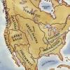
Woodlands Map
Source Institutions
This is a culminating activity which allows learners to summarize what they know about Woodlands Native Americans by creating illustrations and map symbols for a large outline map (see related Activit
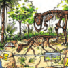
Dinosaur Interaction
Source Institutions
In this activity, learners explore why animals, specifically dinosaurs, live in families.
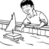
Prepare for a Dock Shop Field Trip
Source Institutions
In this activity, learners explore what makes a boat float and sink. They examine and test various objects to determine why objects float or sink.

Make a Cast of a Tyrannosaurus rex Fossil
Source Institutions
In this activity, learners explore dinosaur fossils by making cast models of a T. rex. First, learners read about and research how dinosaur fossils form.
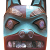
Who Do You Think You Are?
Source Institutions
In this activity, learners use maps to locate the Northwest Coastal region.