Search Results
Showing results 21 to 27 of 27

Exploring Earth: Temperature Mapping
Source Institutions
This activity models the way Landsat satellites use a thermal infrared sensor to measure land surface temperatures.
How is Coastal Temperature Influenced by the Great Lakes and the Ocean?
Source Institutions
In this two-part lesson, learners discover how large bodies of water can serve as a heat source or sink at different times and how proximity to water moderates climate along the coast.
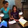
Doghouse Design
Source Institutions
This activity (on page 2 of the PDF under SciGirls Activity: Doghouse Design) is a full inquiry investigation into absorption and reflection of radiant energy.
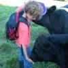
Virtual Farm Management
Source Institutions
This activity (located on page 3 of the PDF under GPS: Farm Animals Activity) is a full inquiry investigation into raising livestock.
Exploring Earth: Investigating Clouds
Source Institutions
“Exploring Earth: Investigating Clouds” is a hands-on activity in which visitors create a cloud in a bottle and explore it with laser light.
Make Your Own Weather Station
Source Institutions
This three-part activity shows learners how to build three meteorology tools: a wind vane, a rain gauge, and a barometer.
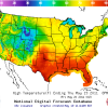
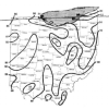
Forward Thinking
Source Institutions
In this activity, learners create their own weather forecast map.