Search Results
Showing results 1 to 5 of 5
Kelsey: Clues of the Dig Site Map
Source Institutions
In this activity, learners explore dinosaur fossils and a dig site. Learners work in groups to analyze a dig site map and match bones to a skeletal drawing of Kelsey (a Triceratops).
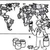
The Poor Cartographer: Graph Coloring
Source Institutions
In this activity, learners help a poor cartographer color in the countries on a map, making sure each country is colored a different color than any of its neighbors.
Tropical Belt
Source Institutions
This lesson familiarizes learners with the term "tropical belt." First, learners locate the equator, Tropic of Cancer and Tropic of Capricorn on a map and trace these lines with a crayon.
Create a Pasta Population Map
Source Institutions
Learners work as a group to create a map of their community. They use pasta to represent people, and glue the pasta on their maps to show areas of large population.

If Anyone Can, Icon
Source Institutions
In this activity, learners create their own icons for a forecast-at-a-glance poster for their classroom/learning space.