Search Results
Showing results 1 to 4 of 4
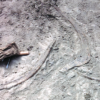
Kelsey: Clues of the Dig Site Map
Source Institutions
In this activity, learners explore dinosaur fossils and a dig site. Learners work in groups to analyze a dig site map and match bones to a skeletal drawing of Kelsey (a Triceratops).

Drawing Conclusions
Source Institutions
In this weather forecasting activity, learners determine the location of cold and warm fronts on weather plot maps.
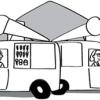
Tourist Town: Dominating Sets
Source Institutions
In this activity, learners use a fictitious map of "Tourist Town" and counters to problem solve how to place ice-cream vans on street intersections so that every other intersection is connected to one

Aerial Imagery
Source Institutions
This activity (on page 2 of the PDF under SciGirls Activity: Earthquakes) is a full inquiry investigation into aerial imagery.