Source Institutions
Source Institutions
Add to list Go to activity
Activity link broken? See if it's at the internet archive
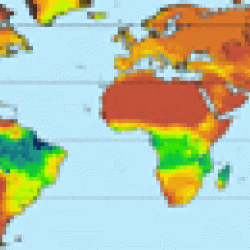
In this activity, learners will examine various world data maps to combine the information and predict which areas could be tropical rainforests. This will help learners discover how living and non-living ecosystem components influence each other. Learners will make their predictions by circling the areas that they think are rainforests on a blank map. Then, educators will reveal a sequence of maps so that learners can see how close they were to locating tropical rainforests. This lesson includes extension ideas, background information, and is standards-based.
- 5 to 10 minutes
- 45 to 60 minutes
- 1 cent - $1 per group of students
- Ages 8 - 14
- Activity, Lesson/Lesson Plan
- English
Quick Guide
Materials List (per group of students)
- blank world maps
- world temperature maps
- world precipitation maps
- world soil maps
- world biodiversity maps
- colored pencils (each learner needs four different colors)
- tropical rainforest maps on transparencies
Subjects
-
Earth and Space Science
-
Earth Processes
- Weather and Climate
-
Earth Structure
- Biosphere
-
Earth Processes
-
Life Sciences
-
Ecology
- Ecosystems
-
Ecology
-
Mathematics
-
Data Analysis and Probability
- Data Analysis
- Data Representation
-
Data Analysis and Probability
-
The Nature of Science
-
The Scientific Process
- Conducting Investigations
- Formulating Explanations
-
The Scientific Process
Informal Categories
- Nature and Environment
Audience
To use this activity, learners need to:
- see
- see color
- read
- touch
Learning styles supported:
- Involves hands-on or lab activities
Other
Components that are part of this resource:
Includes alignment to state and/or national standards:
This resource is part of:
Access Rights:
- Free access
By:
Rights:
- All rights reserved, California Academy of Sciences, 2007