Source Institutions
Source Institutions
Add to list Go to activity
Activity link broken? See if it's at the internet archive

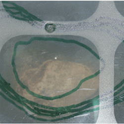
In this activity related to climate change, learners create and explore topographical maps as a means of studying sea level rise. Learners use various everyday materials including ice and a potato to investigate the difference between sea ice and glaciers in relation to sea level rise, create and use a topographical map to predict sea level rise, and discuss how sea level rise will affect Alaska's coastline. This lesson plan includes detailed activity procedure guidelines, critical thinking questions, an overhead, and handouts. NOTE: material cost does not include cost to purchase DVD since it is not essential to the activity.
- 5 to 10 minutes
- 45 to 60 minutes
- $1 - $5 per group of students
- Ages 14 - 18
- Activity, Experiment/Lab Activity, Lesson/Lesson Plan, Simulation
- English
Quick Guide
Materials List (per group of students)
- Beakers
- Pitcher
- Ice cubes
- Potatoes (cut in 1/2)
- Clear plastic tubs with flat bottom and clear plastic lid
- Water soluble markers
- Centimeter rulers
- Kitchen knife
- Water
- Blue food coloring
- White paper
- Scissors
- Clear tape
- Global Climate Interactive DVD
- OVERHEAD: “Map of Shishmaref”
- STUDENT INFORMATION SHEET: “Sea Level Mapping”
- STUDENT WORKSHEET: “The Rising Coast”
Subjects
-
Earth and Space Science
-
Earth Processes
- Geochemical Cycles
- Weather and Climate
-
Earth Structure
- Oceans and Water
- Atmosphere
-
Earth Processes
-
Life Sciences
-
Ecology
- Ecosystems
- Human Impact
-
Ecology
-
Mathematics
-
Data Analysis and Probability
- Data Analysis
- Data Collection
- Data Representation
- Probability
-
Measurement
- Size and Scale
- Reasoning and Proof
- Representation
-
Data Analysis and Probability
-
The Nature of Technology
-
The Design Process
- Problem Solving
-
The Design Process
-
Physical Sciences
-
States of Matter
- Changes of Phase
-
States of Matter
-
The Nature of Science
-
Science and Society
- Risks and Benefits
-
The Scientific Process
- Asking Questions
- Conducting Investigations
- Gathering Data
- Formulating Explanations
- Communicating Results
-
Science and Society
Informal Categories
- Food and Cooking
- Nature and Environment
Audience
To use this activity, learners need to:
- see
- read
- touch
Learning styles supported:
- Involves teamwork and communication skills
- Involves hands-on or lab activities
Other
Components that are part of this resource:
Includes alignment to state and/or national standards:
This resource is part of:
Access Rights:
- Free access
By:
Rights:
- All rights reserved, UAF Geophysical Institute, 2008
Funding Source:
- National Science Foundation ITEST program
