Source Institutions
Source Institutions
Add to list Go to activity
Activity link broken? See if it's at the internet archive
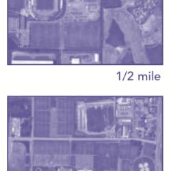
This activity (on page 2 of the PDF under SciGirls Activity: Earthquakes) is a full inquiry investigation into aerial imagery. Learners will use the internet to gather free aerial imagery of nearby points of interest (or use laminated images prepped by educator). Then, they will imagine they are traveling in a spaceship to visit Earth for the first time and explore how their view changes as they approach Earth’s surface. Relates to linked video, DragonflyTV GPS: Earthquakes.
- 10 to 30 minutes
- 45 to 60 minutes
- free per group of students
- Ages 8 - 14
- Activity, Lesson/Lesson Plan, Simulation
- English
Quick Guide
Materials List (per group of students)
- computer access to the Internet, to gather free aerial imagery of points of interest near you. Examples are Google Earth (http://earth.google.com/), or Terraserver (http://terraserv- er.homeadvisor.msn.com/). Inexpensive imaging software is also available from EarthBrowser (http://www.earthbrowser.com /download.html).
Subjects
-
Earth and Space Science
-
Astronomy
- Probes, Satellites and Spacecraft
-
Earth Processes
- Earthquakes
- Volcanoes and Plate Tectonics
- Weather and Climate
-
Earth Structure
- Oceans and Water
- Atmosphere
- Biosphere
-
Astronomy
-
Mathematics
-
Data Analysis and Probability
- Data Collection
- Measurement
-
Data Analysis and Probability
-
Engineering and Technology
-
Engineering
- Aerospace Engineering
- Civil Engineering
-
Technology
- Information and Communication
-
Engineering
-
Life Sciences
-
Ecology
- Human Impact
-
Ecology
-
The Nature of Science
-
The Scientific Process
- About Inquiry
- Conducting Investigations
- Gathering Data
- Formulating Explanations
- Communicating Results
-
The Scientific Process
-
The Nature of Technology
-
Technology and Society
- Impacts of Technology
- Technology and the Environment
-
Technology and Society
Informal Categories
- Computers
- Nature and Environment
- Photography and Film/Video
Audience
To use this activity, learners need to:
- see
- read
- use keyboard
- use mouse
- touch
Learning styles supported:
- Involves hands-on or lab activities
Culture, ethnicity, and gender
-
Girls
- Highlights STEM opportunities for this group
- Identifies role models or mentors in STEM fields from this group
- Uses inclusive images of people from this group
Other
Components that are part of this resource:
This resource is part of:
Access Rights:
- Free access
By:
Source Collection
- DragonflyTV
Rights:
- All rights reserved, Twin Cities Public Television, Inc., 2006
Funding Source:
- National Science Foundation, 436260