Search Results
Showing results 1 to 20 of 35
Lava Layering: Making and Mapping a Volcano
Source Institutions
In this activity, learners discover how geologists use stratigraphy, the study of layered rock, to understand the sequence of geological events.
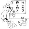
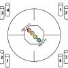
Public Key Encryption: Kid Krypto
Source Institutions
In this activity, learners conduct a simulation exercise related to public key encryption and try to intercept a message sent between two learners.
Kelsey: Clues of the Dig Site Map
Source Institutions
In this activity, learners explore dinosaur fossils and a dig site. Learners work in groups to analyze a dig site map and match bones to a skeletal drawing of Kelsey (a Triceratops).
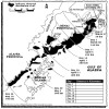
Fragile Waters
Source Institutions
In this activity (on pages 18-29) learners explore the impact of the March 24, 1989 oil spill in Alaska caused by the Exxon Valdez tanker.
The Poor Cartographer: Graph Coloring
Source Institutions
In this activity, learners help a poor cartographer color in the countries on a map, making sure each country is colored a different color than any of its neighbors.
Earth Attractions
Source Institutions
In this activity, learners build and test a compass. Learners work in pairs and pretend they are stuck in the wilderness at night.
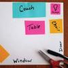
Mapping the Classroom
Source Institutions
In this activity, learners discover the importance of maps and scale as they work together to create a map of the classroom.
Classroom Dinosaur Dig
Source Institutions
In this activity, learners participate in a simulated dig to discover fossilized dinosaur bones. Learners take notes, make a map and propose theories about dinosaurs.
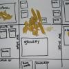
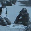
Create a Pasta Population Map
Source Institutions
Learners work as a group to create a map of their community. They use pasta to represent people, and glue the pasta on their maps to show areas of large population.
Particle Detection
Source Institutions
By tossing, collecting, and sorting beanbags, learners understand how the IBEX spacecraft uses its sensors to detect and map the locations of particle types in the interstellar boundary.

Drawing Conclusions
Source Institutions
In this weather forecasting activity, learners determine the location of cold and warm fronts on weather plot maps.
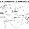
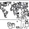
Green Travelers
Source Institutions
In this activity (on pages 23-29), partners use the Plant Traveler Cards, along with a world map and map worksheets, to follow plants such as cassava, chocolate and coffee that grew first in one part

Energy Use in the Americas
Source Institutions
Learners explore the relationship between energy consumption, population, and carbon emissions in the countries of the Americas.

Map That Habitat
Source Institutions
Historically, sea floor mapping (bathymetry) was done by soundings.
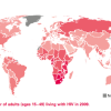
Mapping the Spread of HIV/AIDS: Trailing the Pandemic
Source Institutions
In this activity, learners act as epidemiologists by mapping the prevalence of HIV/AIDS worldwide.
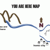
Make A Map for A Treasure Hunt
Source Institutions
In this activity, learners will explore how maps can provide information about a place and help us find our way from one location to another.
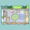
Map Your World
Source Institutions
In this activity, learners map their world by drawing a plan of their bedroom.

Tomb Mapping
Source Institutions
In this activity, learners examine the culture and history of the tomb site.
Plant Patterns
Source Institutions
In this outdoor mapping activity, learners explore where plants grow and map plant-distribution patterns.
Spice World
Source Institutions
In this activity, learners create a map showing the origins of spices and herbs from a favorite recipe(s). Learners first research the origins of the ingredients and then locate them on a world map.