Search Results
Showing results 1 to 8 of 8
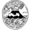
Lava Layering: Making and Mapping a Volcano
Source Institutions
In this activity, learners discover how geologists use stratigraphy, the study of layered rock, to understand the sequence of geological events.
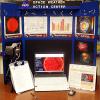
Space Weather Action Center
Source Institutions
In this interdisciplinary activity, learners create a Space Weather Action Center (SWAC) to monitor solar storms and develop real SWAC news reports.
My Angle on Cooling: Effects of Distance and Inclination
Source Institutions
In this activity, learners discover that one way to cool an object in the presence of a heat source is to increase the distance from it or change the angle at which it is faced.
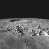
Lava Layers
Source Institutions
In this activity (on pages 11-12 of PDF) learners create models of lava layers that have formed on the moon.
Launch Altitude Tracker
Source Institutions
In this activity, learners construct hand-held altitude trackers. The device is a sighting tube with a marked water level that permits measurement of the inclination of the tube.
Regolith Formation
Source Institutions
In this three-part activity, learners use food to determine the effects of wind, sandblasting and water on regolith (dust) formation and deposition on Earth.
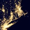
Where Do We Choose to Live and Why?
Source Institutions
In this geography investigation, learners use a nighttime satellite image to observe areas of light across the United States and to identify patterns and spatial distributions of human settlements.
Solar Flip Book
Source Institutions
In this activity, learners make a flip book that shows the progression of two solar events on reversible sides of the flip book.