Search Results
Showing results 1 to 18 of 18
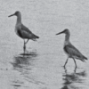
Flocking for Food
Source Institutions
In this outdoor beach activity, learners use a variety of "beaks" (such as trowels, spoons or sticks) to hunt for organisms that shore birds might eat.
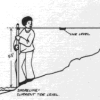
Coastal Erosion: Where's the Beach?
Source Institutions
Learners use beach profile data from a local beach or online data from Ocean City, Maryland to investigate coastal erosion and sediment transport.
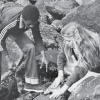
Rock Pioneers
Source Institutions
In this outdoor activity/field trip, learners investigate organisms that live along the ocean's rocky coast.
Tide Pool Survival
Source Institutions
In this activity, learners observe tide pool animals in a touch tank to consider how they survive.
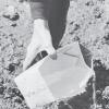
Clam Hooping
Source Institutions
In this two-part outdoor activity, learners conduct a population census of squirting clams on a beach or mudflat, and investigate the clams' natural history.
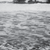
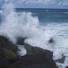
Waves and Tides
Source Institutions
In this 7-10 day investigation, learners develop an understanding of waves and tides and their motion through discussion, demonstration, and hands-on activities.
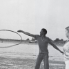
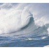
Seas in Motion
Source Institutions
In this outdoor, beach activity, learners use tennis balls, water balloons and other simple devices to investigate the movement of waves and currents off a sandy beach.
Beach Zonation
Source Institutions
In this outdoor, ocean-side activity, learners investigate the distribution of organisms in the upper region of the intertidal zone.
Salt Water Revival
Source Institutions
In this outdoor activity, learners visit the intertidal zone of a rocky coastal site well populated with marine organisms.
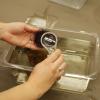
Exploration Tank
Source Institutions
This is a guide for facilitating interaction at a touch tank with marine animals. The instructions are for setting up a display in an informal science center, but could work anywhere.
Modeling Tidal Action
Source Institutions
In this activity (Lesson 1), learners work in groups to create tide simulations.
Exploring Earth: Rising Sea
Source Institutions
“Exploring Earth: Rising Sea” is a hands-on activity demonstrating ways to use topographical mapping techniques to track changes in sea level. The activity is connected to current NASA research.
The Ins and Outs of Tides: Learn About Causes and Predictions
Source Institutions
In this activity, learners will compare predicted and observed tides using data from The National Oceanic and Atmospheric Administration(NOAA).
The Blue Crab's Chesapeake Journey
Source Institutions
In this data collection activity about crabs, learners use data from the Virginia Institute of Marine Science (VIMS) trawl survey to determine the areas of the Chesapeake Bay that are being used by bl
Harmful Algal Blooms: In Full Bloom
Source Institutions
In this activity, learners will investigate the impacts of harmful phytoplankton using NOAA's Coastal Services Center Harmful Algal Bloom Forecasting (HABF) Project data.
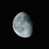
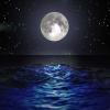
Moonlight Serenade
Source Institutions
In this activity, learners act as the Earth and observe how different angles between the Sun, Earth, and Moon affect the phases of the moon we see each month.
The Wave
Source Institutions
In this multi-step experiment (page 4 of pdf), learners study tide pools, and then drop a "wave" (a 4-pound bag of beans or birdseed) on a shell to mimic the force of crashing surf on tide pool animal
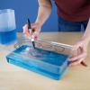
Water on the Move: Wind and Waves
Source Institutions
In this simple activity, learners explore ocean waves. To find out if water moves forward toward the shore, learners create waves in a simulated ocean (small aquarium tank of water).