Search Results
Showing results 341 to 360 of 469
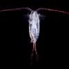
Plankton Feeding
Source Institutions
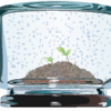
This activity provides a hands-on experience with a scale model, a relatively high viscosity fluid, and feeding behaviors.
Using a Sundial
Source Institutions
In this activity (on page 12 of the PDF), learners make a sundial (shadow clock) appropriate for their geographic location in the northern hemisphere and use it to tell time.
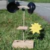
Weather Vane and Anemometer
Source Institutions
In this meteorology activity, learners construct simple devices to measure the direction and speed of wind.
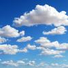
What is a "Model"?
Source Institutions
In this activity, learners simulate the behavior of the atmosphere.
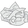
Crumple a Watershed
Source Institutions
Learners gain an intuitive knowledge of the physical aspects of watersheds by creating their own watershed models.
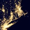
Where Do We Choose to Live and Why?
Source Institutions
In this geography investigation, learners use a nighttime satellite image to observe areas of light across the United States and to identify patterns and spatial distributions of human settlements.
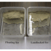
Global Climate Change and Sea Level Rise
Source Institutions
In this activity, learners practice the steps involved in a scientific investigation while learning why ice formations on land (not those on water) will cause a rise in sea level upon melting.
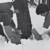
Wintergreen
Source Institutions
In this outdoor, winter activity, learners find living green plants under the snow and determine the light and temperature conditions around the plants.
Photosynthesis and Transpiration
Source Institutions
In this activity on page 7 of the PDF (Plants—The Green Machines), learners examine the effects that light and air have on green plants.
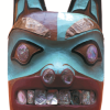
Who Do You Think You Are?
Source Institutions
In this activity, learners use maps to locate the Northwest Coastal region.

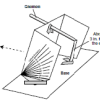
Reflective Solar Cooker
Source Institutions
In this activity, learners use the Sun's energy to cook marshmallows. Learners construct the solar oven out of simple everyday materials.

Aerial Imagery
Source Institutions
This activity (on page 2 of the PDF under SciGirls Activity: Earthquakes) is a full inquiry investigation into aerial imagery.
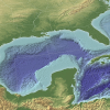
The Dead Zone: A Marine Horror Story
Source Institutions
In this environmental science and data analysis activity, learners work in groups to track a Dead Zone (decreased dissolved oxygen content of a body of water) using water quality data from the Nutrien
Without An Ark: The Effects of Storms and Floods
Source Institutions
April showers bring May flowers, but what do coastal storms bring?
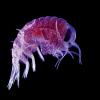
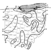
Plankton Races
Source Institutions
In this two-part activity, learners investigate buoyancy, density and surface area as well as biodiversity and the relationship between the structure and function of organisms.
How is Coastal Temperature Influenced by the Great Lakes and the Ocean?
Source Institutions
In this two-part lesson, learners discover how large bodies of water can serve as a heat source or sink at different times and how proximity to water moderates climate along the coast.
Modeling the Night Sky
Source Institutions
In this two-part activity, learners explore the Earth and Sun's positions in relation to the constellations of the ecliptic with a small model.
The Web of Life
Source Institutions
In this activity, learners examine ways that Native Americans of the Southwest express their relationship with nature through art.

Chilean Sea Bass: Off the Menu
Source Institutions
In this data analysis activity, learners use data collected by the Commission for the Conservation of Antarctic Marine Living Resources (CCAMLR) to study Chilean sea bass populations.
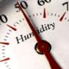
Making Sense of Sensors
Source Institutions
In this activity, learners explore sensors and focus specifically on how to measure humidity using a sensor.