Search Results
Showing results 1 to 3 of 3
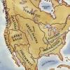
Woodlands Map
Source Institutions
This is a culminating activity which allows learners to summarize what they know about Woodlands Native Americans by creating illustrations and map symbols for a large outline map (see related Activit
Take a Tectonic Vacation
Source Institutions
This multi-part activity from the National Parks Service blends the science of plate tectonics with the culture and history of places with dramatic geologic landscapes.

Where Do We Choose to Live and Why?
Source Institutions
In this geography investigation, learners use a nighttime satellite image to observe areas of light across the United States and to identify patterns and spatial distributions of human settlements.