Search Results
Showing results 1 to 7 of 7
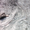
Kelsey: Clues of the Dig Site Map
Source Institutions
In this activity, learners explore dinosaur fossils and a dig site. Learners work in groups to analyze a dig site map and match bones to a skeletal drawing of Kelsey (a Triceratops).

Drawing Conclusions
Source Institutions
In this weather forecasting activity, learners determine the location of cold and warm fronts on weather plot maps.

Tomb Mapping
Source Institutions
In this activity, learners examine the culture and history of the tomb site.

Where in the World is the Terra Cotta Army?
Source Institutions
In this activity, learners find Xi'an, the archaeological area in China where the Terra Cotta Army was discovered, on a map or globe and look more closely at the relationship of the warrior site to ot

Aerial Imagery
Source Institutions
This activity (on page 2 of the PDF under SciGirls Activity: Earthquakes) is a full inquiry investigation into aerial imagery.
Tropical Belt
Source Institutions
This lesson familiarizes learners with the term "tropical belt." First, learners locate the equator, Tropic of Cancer and Tropic of Capricorn on a map and trace these lines with a crayon.

To Topo Two
Source Institutions
In this activity, two groups of learners create two separate landform models out of clay (mountains and valleys).