Search Results
Showing results 1 to 20 of 59
Fossilized Dinosaur Teeth Adaptations
Source Institutions
In this activity, learners use models of fossilized dinosaur teeth to understand how dinosaur teeth were used.
The Geophysical Light/Dark Cycle
Source Institutions
This is an activity (located on page 131 of the PDF) related to sleep and circadian rhythms as well as space travel.
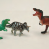
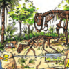
Join the Dinosaur Age
Source Institutions
In this activity, learners rotate through several learning and play stations to explore dinosaurs and paleontologists.
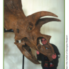
Kelsey: Clues of the Dig Site Map
Source Institutions
In this activity, learners explore dinosaur fossils and a dig site. Learners work in groups to analyze a dig site map and match bones to a skeletal drawing of Kelsey (a Triceratops).
Hold a Hill
Source Institutions
In this outdoor activity, learners investigate the relationship between the slope of a trail and soil erosion.
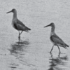
Flocking for Food
Source Institutions
In this outdoor beach activity, learners use a variety of "beaks" (such as trowels, spoons or sticks) to hunt for organisms that shore birds might eat.
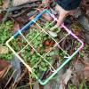
Counting With Quadrants
Source Institutions
Millions of organisms can live in and around a body of water.

Make a Dinosaur Model
Source Institutions
In this activity, learners explore dinosaur skeletons, anatomy, and locomotion. Learners compare and contrast dinosaur skeletons and drawings.
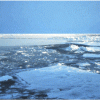
Arctic Sea Ice
Source Institutions
In this activity, learners explore how the area of Arctic sea ice has changed over recent years. First, learners graph the area of Arctic sea ice over time from 1979 to 2007.
Coastal Erosion: Where's the Beach?
Source Institutions
Learners use beach profile data from a local beach or online data from Ocean City, Maryland to investigate coastal erosion and sediment transport.
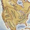
Woodlands Map
Source Institutions
This is a culminating activity which allows learners to summarize what they know about Woodlands Native Americans by creating illustrations and map symbols for a large outline map (see related Activit
Discovering Rainforest Locations
Source Institutions
In this activity, learners will examine various world data maps to combine the information and predict which areas could be tropical rainforests.
Mapping Sea Level Rise
Source Institutions
In this activity related to climate change, learners create and explore topographical maps as a means of studying sea level rise.
Supersize That Dinosaur
Source Institutions
In this activity, learners explore the size and scale of dinosaurs. Learners listen to "The Littlest Dinosaurs" by Bernard Most. Then, learners estimate the size of a Triceratops and T.
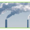
Mapping Greenhouse Gas Emissions Where You Live
Source Institutions
In this lesson plan, learners examine some of the of greenhouse gas emissions sources in their community.
Dinosaur Interaction
Source Institutions
In this activity, learners explore why animals, specifically dinosaurs, live in families.
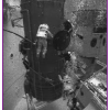
Weighty Questions
Source Institutions
In this activity about humans and space travel (page 1 of PDF), learners compare and contrast the behavior of a water-filled plastic bag, both outside and inside of a container of water.
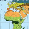
Tropical Belt
Source Institutions
This lesson familiarizes learners with the term "tropical belt." First, learners locate the equator, Tropic of Cancer and Tropic of Capricorn on a map and trace these lines with a crayon.

Avogadro's Bubbly Adventure
Source Institutions
In this activity on page 7 of the PDF, learners investigate the solubility of gas in water at different temperatures. This experiment will help learners determine if temperature affects solubility.
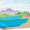
The Carbon Cycle and its Role in Climate Change: Activity 1
Source Institutions
In this activity (on page 1), learners role play as atoms to explore how atoms can be rearranged to make different materials.