Search Results
Showing results 1 to 9 of 9
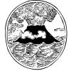
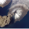
Lava Layering: Making and Mapping a Volcano
Source Institutions
In this activity, learners discover how geologists use stratigraphy, the study of layered rock, to understand the sequence of geological events.
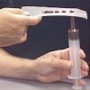
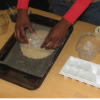
Hot Sauce Hot Spots
Source Institutions
In this activity, learners model hot spot island formation, orientation and progression with condiments.
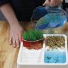
Exploring Earth: Land Cover
Source Institutions
This activity models some of the ways natural processes, such as erosion and sediment pollution, affect Earth’s landscape.
Earth Walk
Source Institutions
In this hands-on and feet-on excursion, learners take a science walk to visualize the planet's immense size and numerous structures, without the usual scale and ratio dimensions found in most textbook

Exploring the Universe: Static Electricity
Source Institutions
This activity encourages visitors to build an electroscope—a simplified version of one of the tools scientists use to study the invisible forces on Earth and in space.

Earthquake Energy
Source Institutions
In this geology activity (page 3 of the PDF), learners simulate an earthquake with little more than an elastic band and drinking straws.
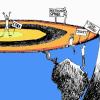
Earth and Mars
Source Institutions
Based on color photographic images, learners compare geological features on Earth and Mars to understand similarities and differences between the two planets, and consider the forces that created land
Ice on Mars
Source Institutions
In this activity, learners use sand and ice cubes to create a model of permafrost and the effects of the ice melting through the surface.

Exploring Earth: Temperature Mapping
Source Institutions
This activity models the way Landsat satellites use a thermal infrared sensor to measure land surface temperatures.