Search Results
Showing results 21 to 26 of 26
Tropical Belt
Source Institutions
This lesson familiarizes learners with the term "tropical belt." First, learners locate the equator, Tropic of Cancer and Tropic of Capricorn on a map and trace these lines with a crayon.

To Topo Two
Source Institutions
In this activity, two groups of learners create two separate landform models out of clay (mountains and valleys).
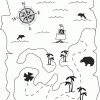
Treasure Hunters
Source Institutions
Learners use their opponent's clues and a compass rose to find the hidden treasure on a map. Learners use problem solving and coordinate grid skills as they hunt for treasure.
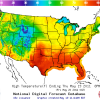
Forward Thinking
Source Institutions
In this activity, learners create their own weather forecast map.
If Anyone Can, Icon
Source Institutions
In this activity, learners create their own icons for a forecast-at-a-glance poster for their classroom/learning space.
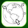
Where on Earth?
Source Institutions
Learners look at labels on items in the room to determine where each item was manufactured, then write about the item on an index card.