Search Results
Showing results 1 to 20 of 30
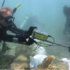
Excavating and Mapping Under Water
Source Institutions
In this archaeology activity, learners consider ways in which excavating an underwater site is different from excavating a terrestrial site.
Mercury in the Environment
Source Institutions
In this environmental science lesson, learners will examine the dangers of mercury and how humans contribute to growing mercury emissions on Earth.
Start a Rock Collection
Source Institutions
Learners follow a three-step process to start their own rock collection.
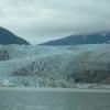
Glaciers
Source Institutions
In this online activity, learners adjust mountain snowfall and temperature to see how glaciers grow and shrink. They will use scientific tools to measure thickness, velocity and glacial budget.
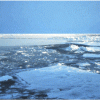
Arctic Sea Ice
Source Institutions
In this activity, learners explore how the area of Arctic sea ice has changed over recent years. First, learners graph the area of Arctic sea ice over time from 1979 to 2007.
Coastal Erosion: Where's the Beach?
Source Institutions
Learners use beach profile data from a local beach or online data from Ocean City, Maryland to investigate coastal erosion and sediment transport.
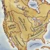
Woodlands Map
Source Institutions
This is a culminating activity which allows learners to summarize what they know about Woodlands Native Americans by creating illustrations and map symbols for a large outline map (see related Activit
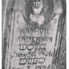
Gravestone Weathering
Source Institutions
In this activity (located on pages 9-14 of PDF), learners visit a cemetery to examine the distinguishing characteristics of rock weathering.
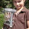
Make a Terrarium
Source Institutions
In this activity, learners make a miniature greenhouse or "terrarium" to explore the greenhouse effect.
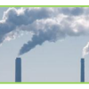
Mapping Greenhouse Gas Emissions Where You Live
Source Institutions
In this lesson plan, learners examine some of the of greenhouse gas emissions sources in their community.
Kid Moon: Splat!
Source Institutions
In this activity, learners model ancient lunar impacts using water balloons.
Old Faithful Plumbing Investigation
Source Institutions
This activity (located on page 3 of the PDF) is a full inquiry investigation into mapping the underground “plumbing” of geysers.
Tree Growth Investigation
Source Institutions
This activity (located on page 3 of the PDF under GPS: Temperate Rain Forest Activity) is a full inquiry investigation into tree growth rates.
Sand Grain Observations
Source Institutions
In this activity (on page 1 of the PDF under SciGirls Activity: Earthquakes), learners will use a magnifier to carefully examine samples of sand from different locations.
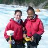
Mini Glacier Meltdown
Source Institutions
This activity (located on page 3 of the PDF under GPS: Glaciers Activity) is a full inquiry investigation about the different causes of glacial melt.
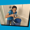
Shower Estimation
Source Institutions
In this activity, learners calculate their water usage (in cups and galloons) during an average shower. Learners also chart and analyze water usage during showers in their households.
Moving Model Glacier
Source Institutions
In this goopy activity (page 2 of PDF under GPS: Glaciers Activity), learners will model glacial movement with “gak,” a white glue and liquid starch mixture.

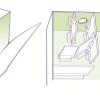
Tomb Mapping
Source Institutions
In this activity, learners examine the culture and history of the tomb site.
Looking Back Through Time
Source Institutions
In this activity, learners create their own archaeological profiles.
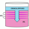
Liesegang Rings
Source Institutions
This display shows slow chemical reactions in colorful crystal formations known as Liesegang Rings. These reactions are similar to those forming the rings in agates.