Search Results
Showing results 1 to 20 of 74
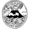
Lava Layering: Making and Mapping a Volcano
Source Institutions
In this activity, learners discover how geologists use stratigraphy, the study of layered rock, to understand the sequence of geological events.
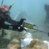
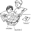
Excavating and Mapping Under Water
Source Institutions
In this archaeology activity, learners consider ways in which excavating an underwater site is different from excavating a terrestrial site.
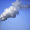
Mercury in the Environment
Source Institutions
In this environmental science lesson, learners will examine the dangers of mercury and how humans contribute to growing mercury emissions on Earth.
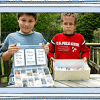
Start a Rock Collection
Source Institutions
Learners follow a three-step process to start their own rock collection.
Glaciers
Source Institutions
In this online activity, learners adjust mountain snowfall and temperature to see how glaciers grow and shrink. They will use scientific tools to measure thickness, velocity and glacial budget.
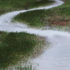
Stream Table
Source Institutions
In this activity, learners use aluminum trays and wooden blocks to form stream tables to investigate river formations in two different landscape scenarios.
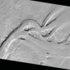
Mars from Above: Carving Channels
Source Institutions
In this activity, learners create channel features with flowing water, comparing their observations to real images of Mars and Earth taken by satellites/orbiters.
Vanishing Craters
Source Institutions
In this activity (on pages 12-15), learners make a crater model and test the effects of weather (rain) on its surface.
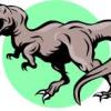
How We Know What The Dinosaurs Looked Like: How Fossils Were Formed
Source Institutions
In this activity (p.7-8 of PDF), learners examine fossil formation.
Future Moon: The Footsteps of Explorers
Source Institutions
In this activity, learners drop impactors onto layers of graham crackers!
Infant Moon: Moon Mix!
Source Institutions
In this activity, learners investigate the Moon's infancy and model how an ocean of molten rock (magma) helped shape the Moon that we see today.
Exploring the Solar System: Stomp Rockets
Source Institutions
In "Exploring the Solar System: Stomp Rockets," participants learn about how some rockets carry science tools—not scientists—into space, and how a special kind of rocket called "sounding rockets" can
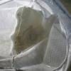
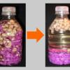
Collect Invertebrates to Determine Water Quality
Source Institutions
This activity (located on page 3 of the PDF under GPS: Alligator Habitat Activity) is a full inquiry investigation into organisms and the health of their ecosystems.
What Does Life Need to Live?
Source Institutions
In this astrobiology activity (on page 11 of the PDF), learners consider what organisms need in order to live (water, nutrients, and energy).
Pollen Tracks
Source Institutions
In this activity (on pages 30-36), learners simulate a dig for ancient pollen, to experience how paleobotanists study fossilized pollen in rocks to learn about early geological and climatological even
The Carbon Cycle: How It Works
Source Institutions
In this game, learners walk through an imaginary Carbon Cycle and explore the ways in which carbon is stored in reservoirs and the processes that transport the carbon atom from one location to another
Dinosaur Breath
Through discussion and hands-on experimentation, learners examine the geological (ancient) carbon cycle.
A Crayon Rock Cycle- Metamorphic
Source Institutions
This is part 2 of the three-part "Crayon Rock Cycle" activity and must be done after part 1: Sedimentary Rocks. In this activity, learners explore how metamorphic rocks form.
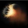
Mars from Above: Viewing Volcanoes
Source Institutions
In this activity, learners create volcanoes like those they have examined on Earth and Mars through images taken by spacecraft.
A Crayon Rock Cycle - Igneous
Source Institutions
This is part 3 of the three-part "Crayon Rock Cycle" activity. Before starting this section, learners must have completed part 1: sedimentary rock and part 2: metamorphic rocks.